

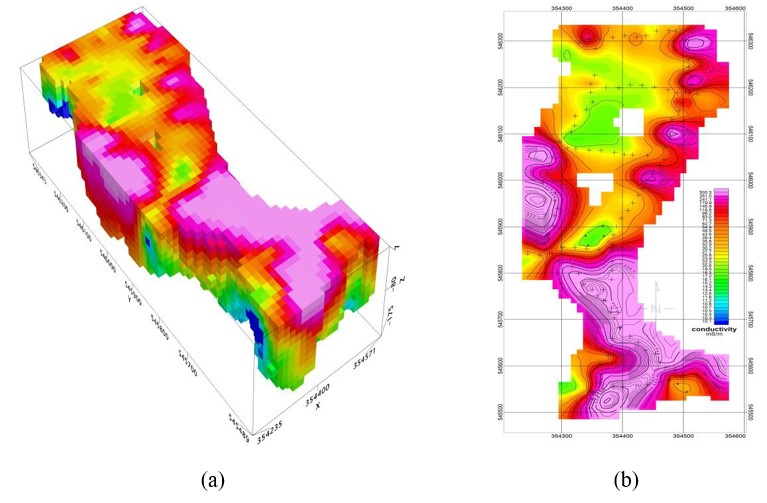
Our company provides a professional service in acquiring high resolution geoelectrical data (resistivity, induced polarization). Electrical resistivity imaging (ERI) is a non-destructive method for subsurface investigations. ERI involves the measurement of the apparent electrical resistivity of subsurface materials. During an ERI survey, the electrical current is injected into the earth through a pair of current electrodes, and the potential difference is measured between a pair of potential electrodes. The current and potential electrodes are generally arranged in a linear array. The apparent resistivity is the bulk average resistivity of all subsurface materials influencing the flow of current. A typical ERI survey involves multiple such measurements of apparent resistivity with various configurations of electrode locations. The data is then processed, and resistivity contour maps are produced to show resistivity variations along depth and horizontal positions. Since the electrical resistivity of subsurface materials varies with their compositions and water contents, the resistivity contour maps can be used to get a general background of the subsurface condition or find interested targets
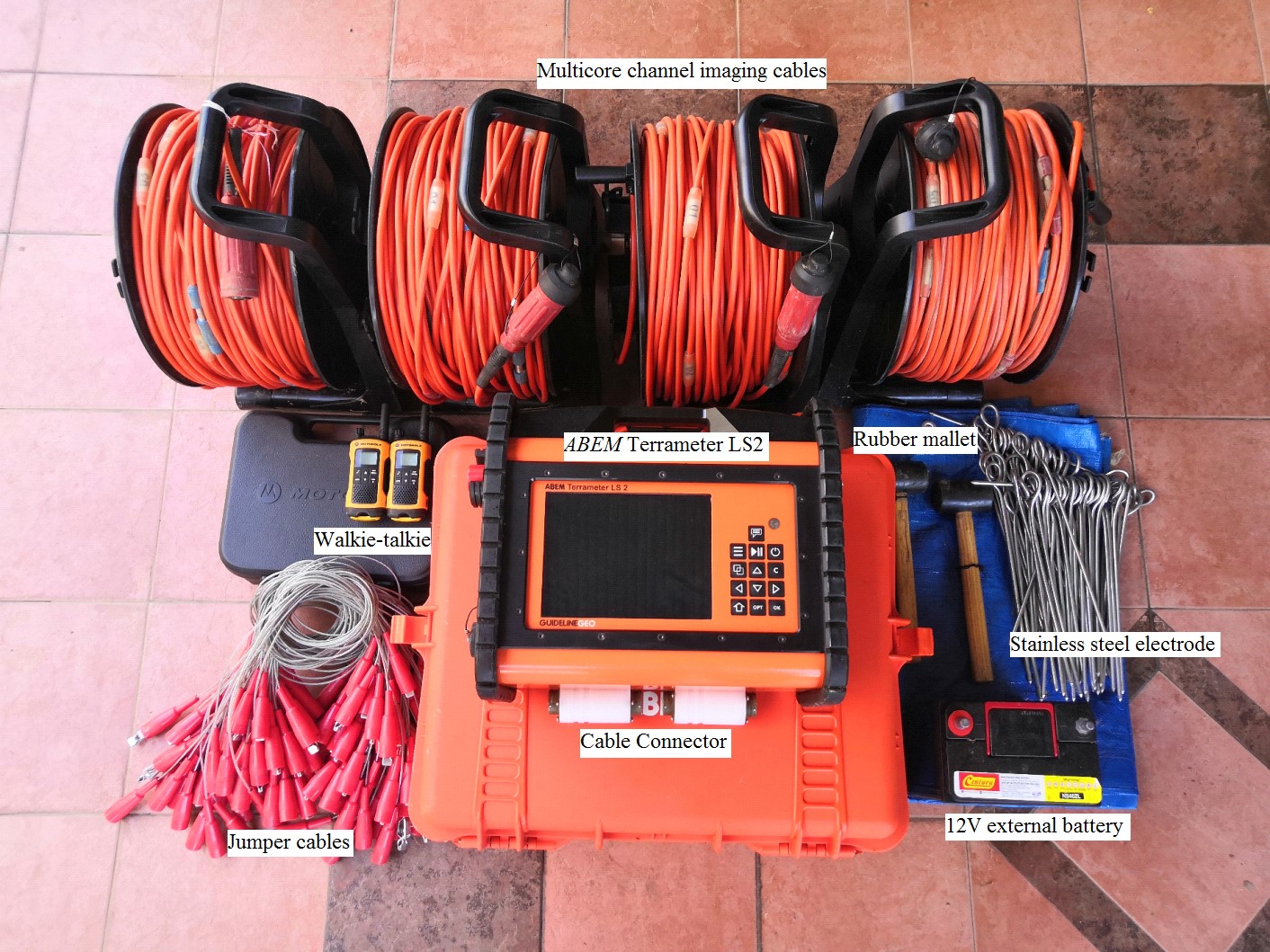
Our company owns Terrameter LS2 set of equipment by ABEM to carry out geoelectrical survey. Data from the equipment will be processed and analysed using RES2DINV software. Interpretations will be made with identifications of the layers of alluvium, bedrock and other geological structures at pseudosection.


